The drive path is highlighted in yellow.
Credits: NASA/JPL-Caltech/MSSS/UofA

Did this short drive really take 1 hour?
The data shows that duration.
We can usually trust this data, although the JSON data is occasionally revised and the JSON updated, after the team have checked the data, but that's rare from what I've observed.
The data is provided by JPL, in their post drive Traverse JSON URL.
That JSON reports the mission clock time in seconds (since landing).
It reports the start-of-drive (SCLK_Start) and end-of-drive (SCLK_End).
The difference between the two timestamps for this drive is 3504 seconds, or 58.4 minutes
I'm assuming the rover paused at some point during its drive although there are no mid drive images (so far), the clock keeps running during pauses for imaging or hazard avoidance.
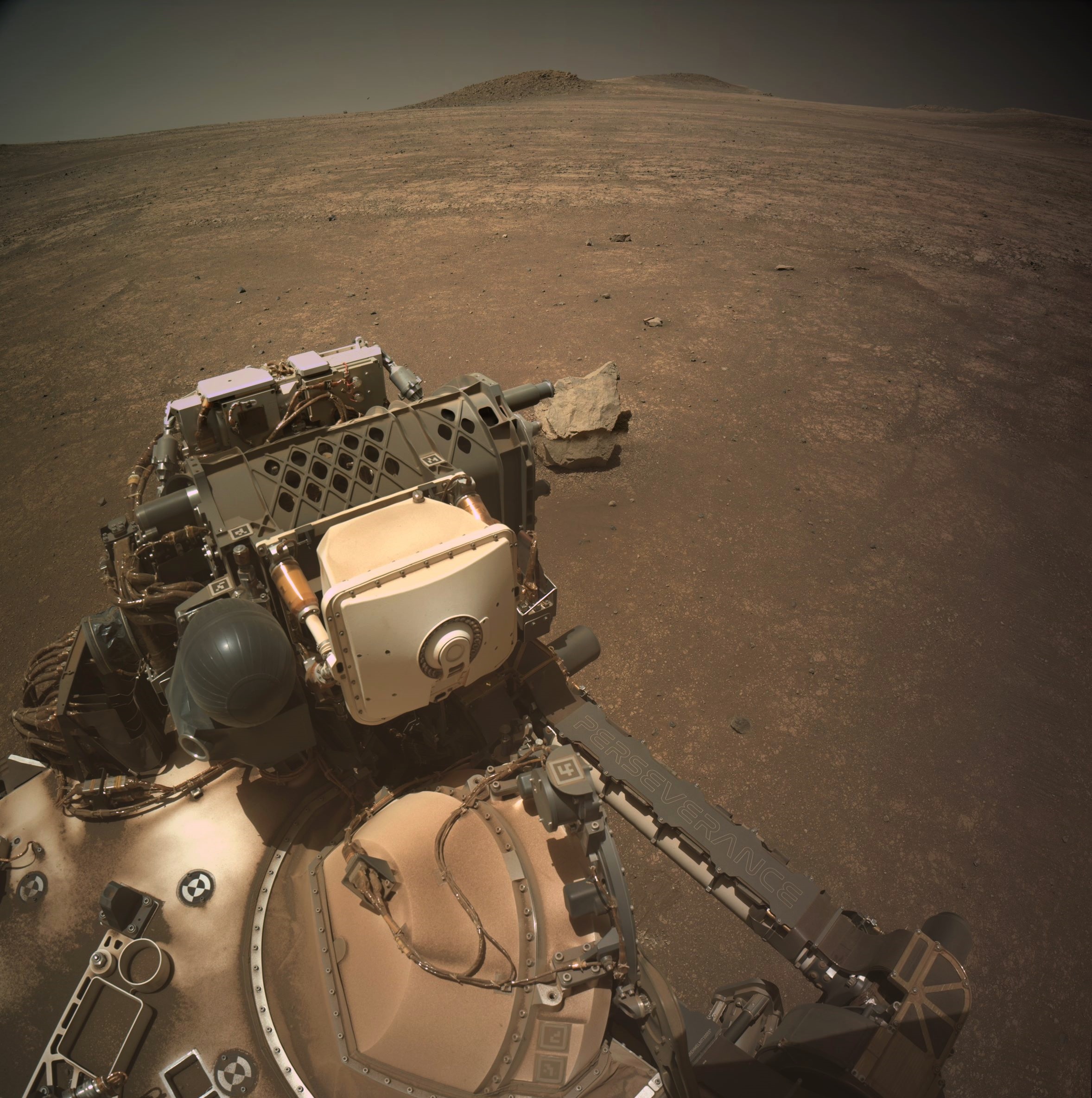
I don't see any hazards, except for the small boulder to the side of the rover at the start of the drive. I've checked the RMC numbers on all the images we have so far from sol 1551, and I don't see any mid-drive images.
There may be some further images that are still on the rover (yet to be downlinked), so let's assume that it paused to drive around that rock (see attached pre-drive HazCam tile)

The drive path is highlighted in yellow.
Credits: NASA/JPL-Caltech/MSSS/UofA
Credits: NASA/JPL-Caltech

Assembled from 15 overlapping Bayer reconstructed L-MastCam images. Credits: NASA/JPL-Caltech/MSSS/fredk

Hopefully this data is presented in a form that folk can understand. However, if it does not make sense please let me know, and I'll answer any questions.
The raw drive data is provided by JPL shortly after each drive, all I do is extract the data from the JSON feeds and present it in this table
Credits: NASA/JPL-Caltech.

Cropped 6-tile NavCam, shows the rover's new workspace while looking South-southeast after a very short move. The team advanced the RMC site number which sometimes points to a potential sample site. Recent attempts to abrade this type of rock have not been fully successful as the surface of the rock has fractured badly. The observant will notice that the surface of this rock was fractured at some point, maybe it's better cemented compared with those earlier attempts. Watch this space and see what happens next.
NASA/JPL-Caltech

Good one 🤣🤣🤣
I'd hazard a guess that is why they returned to this area. Yes the rock is readily fractured, but possibly better cemented than those further west and south. We'll see if they try a new abrasion or just go for a core :)
Just in case you'd missed it: You can turn parts of the map on and off on the Berlin map, eg those camera icons and the rover's current location + See this screen shot

It's a good map, very useful :)
https://lemmy.world/u/SpecialSetOfSieves
May be of some interest :)
Kathir et al: "Multispectral Observations of Float Rocks Used to Investigate the Origin of Boulders on the Western Jezero Fan Front"
https://doi.org/10.1029/2024JE008702
(posted by one of the guys I follow over on Mastodon) :)
The drive path is highlighted yellow

The details are extracted from JPL's public JSON URLs that provide waypoint and traverse data, these are updated shortly after each drive. Credits: NASA/JPL-Caltech

Composite image using 6 overlapping processed NavCam tiles acquired after the drive to site 76.594. Roughly assembled in MS-ICE. Credits: NASA/JPL-Caltech
NASA's Mars Exploration Program seeks to understand whether Mars was, is, or can be a habitable world. Missions like Mars Pathfinder, Mars Exploration Rovers, Mars Science Laboratory and Mars Reconnaissance Orbiter, among many others, have provided important information in understanding of the habitability of Mars. This poster imagines a future day when we have achieved our vision of human exploration of Mars and takes a nostalgic look back at the great imagined milestones of Mars exploration that will someday be celebrated as “historic sites.”
Source https://www.jpl.nasa.gov/galleries/visions-of-the-future/

The drive path is highlighted yellow

The raw drive data is released by JPL shortly after each drive. this table is generated from that raw data. I've also added a few additional data points based on the data


Not looking good. Sol 1548 NavCam tile (processed (NASA/JPL-Caltech)
Third time's a charm? Or time to move on? I'd say go for it again

Nice animation :) Definitely an improvement on the earlier attempt, we see still see some some fracturing, but a lot less movement (side-to-side) movement of the drill (maybe more down-force on the support pillars?). We'll have to wait for the post abrading images after they move the turret away from the site so see what they have achieved. Whatever the results of this abrasion the fact that it readily breaks up, attempts to retain a core will likely be difficult.
Fingers crossed :)
As you say 'It is hard to tell', but going by the reflected light inside the tube in one of the CacheCam frame we have at this time, I'm assuming that that core fell out before it reached the imaging station inside the rover. More images needed :)
Staying tuned :)