this post was submitted on 14 Feb 2024
1 points (100.0% liked)
OpenStreetMap community
4326 readers
1 users here now
Everything #OpenStreetMap related is welcome: software releases, showing of your work, questions about how to tag something, as long as it has to do with OpenStreetMap or OpenStreetMap-related software.
OpenStreetMap is a map of the world, created by people like you and free to use under an open license.
Join OpenStreetMap and start mapping: https://www.openstreetmap.org/.
There are many communication channels about OSM, many organized around a certain country or region. Discover them on https://openstreetmap.community/
https://mapcomplete.org/ is an easy-to-use website to view, edit and add points (such as shops, restaurants and others)
https://learnosm.org/en/ has a lot of information for beginners too.
founded 5 years ago
MODERATORS
you are viewing a single comment's thread
view the rest of the comments
view the rest of the comments


Perth, Australia has similar. Pretty sure the lanes on roads (not station entrances, etc) are shared between taxis and buses.
They also have schedules.
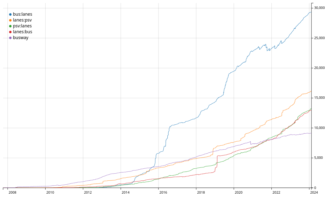
PS: is your image a png with a transparent background? It is hard to see anything on dark mode with the voyager app)
Yes, updated the image, now it has white background.
I just hit download on tag history, and apparently it generates transparent pngs.
@palitu @infeeeee
The first link is to a page that has the graph with a contrasting background.
@palitu @infeeeee #HOV lane?
HOV is different. Psv lane is for buses, taxis, etc, exact rules differ per country. Here police, motorcycles, ambulance, garbage trucks can lso use it. There are cameras which check the license plate of the cars in the lane, and you automatically get a fine if you shouldn't be there