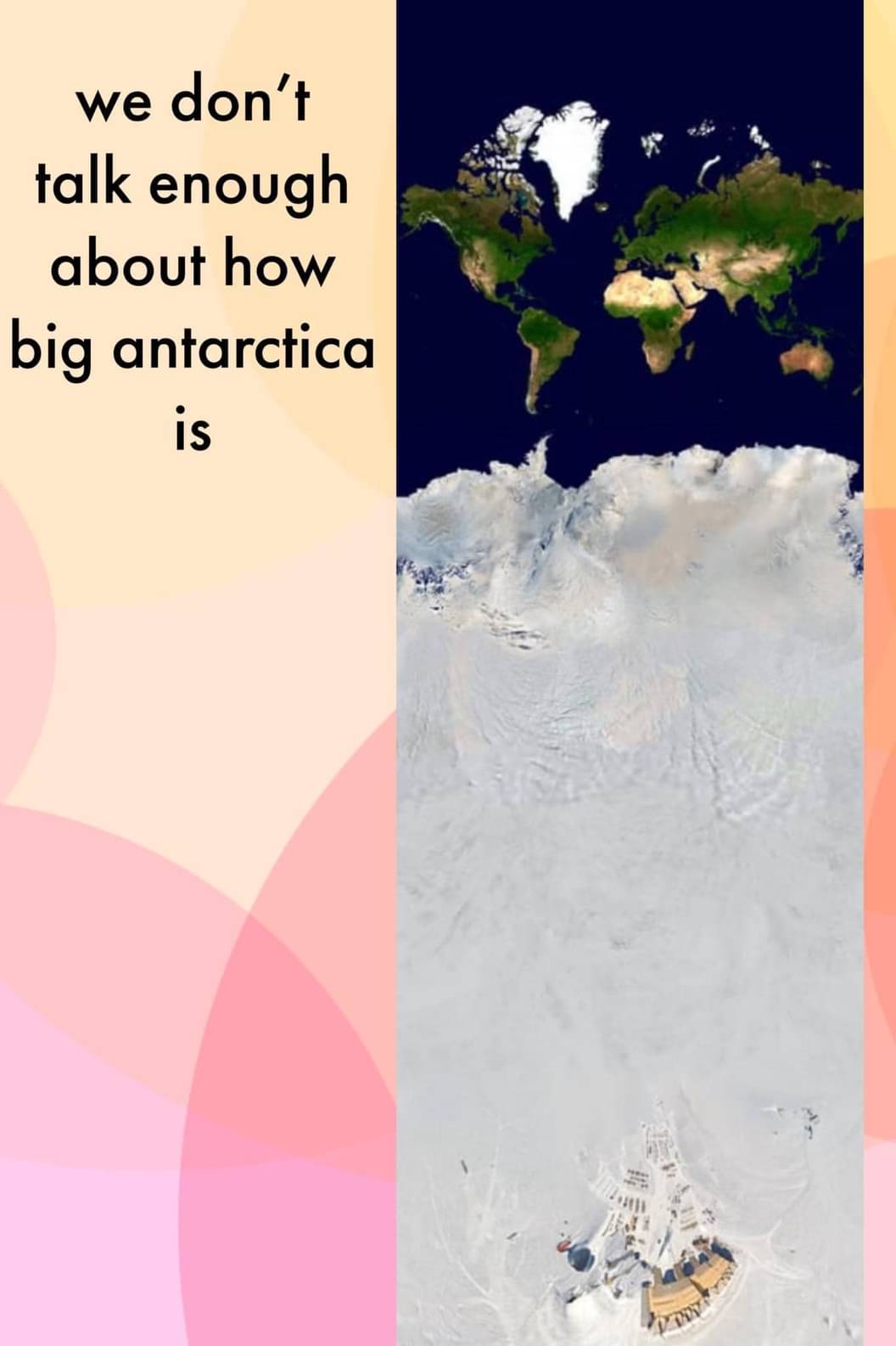
Long Earth theory.
Science Memes
Welcome to c/science_memes @ Mander.xyz!
A place for majestic STEMLORD peacocking, as well as memes about the realities of working in a lab.

Rules
- Don't throw mud. Behave like an intellectual and remember the human.
- Keep it rooted (on topic).
- No spam.
- Infographics welcome, get schooled.
This is a science community. We use the Dawkins definition of meme.
Research Committee
Other Mander Communities
Science and Research
Biology and Life Sciences
- [email protected]
- [email protected]
- [email protected]
- [email protected]
- [email protected]
- [email protected]
- [email protected]
- [email protected]
- [email protected]
- [email protected]
- [email protected]
- [email protected]
- [email protected]
- [email protected]
- [email protected]
- [email protected]
- [email protected]
- [email protected]
- [email protected]
- [email protected]
- [email protected]
- [email protected]
- [email protected]
- [email protected]
- !reptiles and [email protected]
Physical Sciences
- [email protected]
- [email protected]
- [email protected]
- [email protected]
- [email protected]
- [email protected]
- [email protected]
- [email protected]
- [email protected]
Humanities and Social Sciences
Practical and Applied Sciences
- !exercise-and [email protected]
- [email protected]
- !self [email protected]
- [email protected]
- [email protected]
- [email protected]
Memes
Miscellaneous
Wait what? Did we just find Hitler's secret Antarctica base?
That’s the Amundsen–Scott South Pole Station.
Nonsense! Did you see how big that thing is? Definitely Hitler!
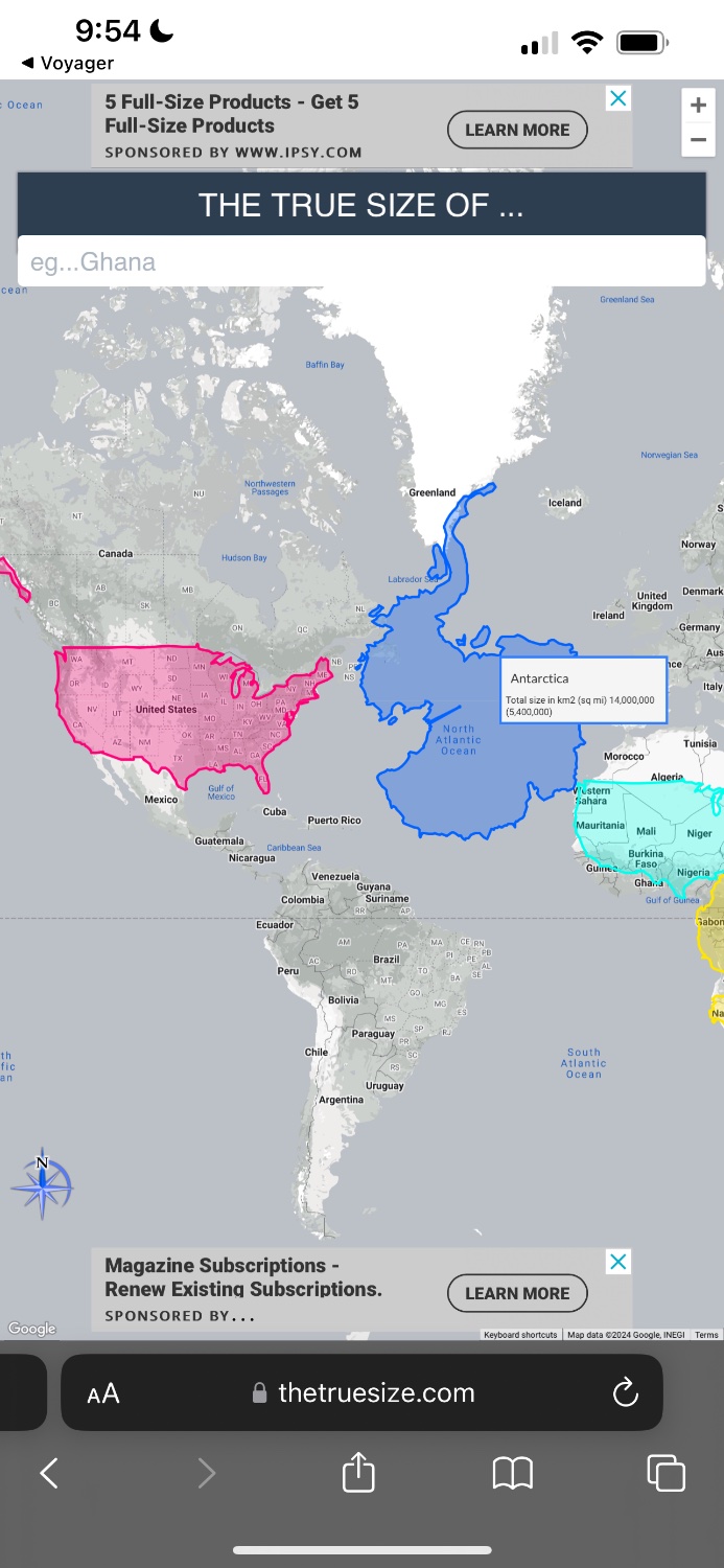
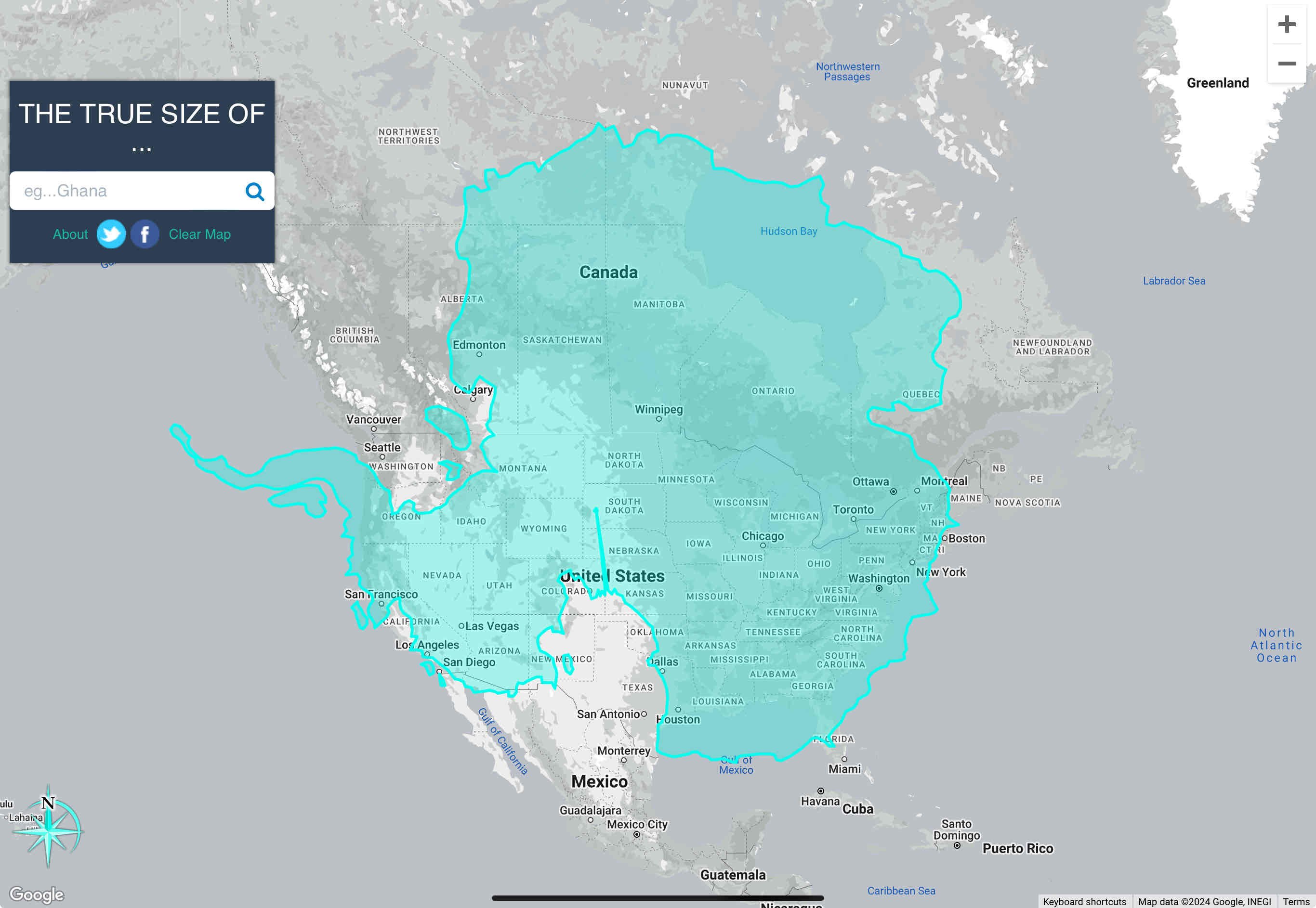
Uh, antartica is about as wide as the U.S. and about as tall as it is wide.
So, I just feel like I’m being bamboozled here
Yeah it's definitely not a real projection. If Antarctica looked like that (taken top down) then the rest of the continents would not be oriented like that.
Mercator maps are lies.
https://www.thetruesize.com/#?borders=1~!MTY2MDE2NDA.NDc5Njc5NwMjE1MTM3Mjc(MzM1MDIwMDg~!AQMTczNjE5MDg.MTI2ODc2MjY)MA
Join the Organization of Cartographers for Social Equality today!
Kalothar is right
https://www.thetruesize.com/#?borders=1~!MTY4NDk1MDM.NTE5OTU2MTc5NjM3NzY(MjAyMDQxNw~!CONTIGUOUS_USMTMzNTM3.MTE1MDkwMTA)MA~!AQ*MTY1OTExMjU.MTE1NjAxMjQ)MQ
Yeah, they certainly are:

That is inaccurate. The correct way to use the tool is to lay the continent over the US. It skews the size and scale appropriately in order to provide an accurate measurement.

It’s also larger in area than the US, including Alaska and all territories.
The total area of the US and its territories is just over 3.8 million square miles. Antarctica's area of 5.4 million square miles makes it 1.5x the size of the US.
It’s also the only continent without a southern coast.
For now. It used to a few million years ago and will again in another few million.
Are you referring to the magnetic pole switch? That happens every 200-1M years, according to patterns on the seafloor. It’s been estimated that the last reversal was 780,000 years ago, so it theoretically could be any day now.
With that being said, I doubt that humanity will agree to turn all maps 180° to correspond.
Laschamp event! I just edited a related wiki page on late Pleistocene extinctions. Spoiler alert: it didn't kill the megafauna.
I thought they were referring to the fact that under the ice its an archipelago, so if the ice melts it will have southern coasts again
Valid point. It’s a shame humanity wouldn’t be around to confirm. lol
Just flip it over lol
the continental plate also migrates
At the rate of 1 CM/year
